
Walk an Indianapolis Street
A useful street directory search moves from the fixed piece of land to records created at different dates. Begin with Marion County Assessor Property Cards, because its address suggestions help normalize the street and return a parcel. Then use the parcel as the stable link among maps, deeds, and tax records. Ownership is not occupancy. A trust, estate, non-occupant owner, or owner with a different mailing address may appear on the card, while other people at the address may not appear there at all.
- Enter the house number and part of the street name in the assessor search, then save the parcel number and situs address.
- Open the parcel in MapIndy. Inspect nearby lots, legal boundaries, and the address point.
- Use the owner name or parcel in the Recorder index. Match the legal description before adding a deed party.
- Check permit and code records by address. Record the case type, date, status, and each named role.
- For an older household, search city-directory street pages for the right year and account for renumbering.
This Indianapolis street directory chain answers several questions without blending them. The assessor supports current parcel research, the recorder documents filed interests, municipal cases describe public activity, and historical directories may show a published household entry. Keep each date beside each result.
Indianapolis Street Directory Fields
The assessor accepts four practical starting points: a seven-digit parcel number, an eighteen-digit state parcel number, all or part of an owner name, or an address. Address search best fits an Indianapolis street directory because a suggested match helps prevent errors in suffixes and spelling. A card can include the owner, owner mailing address, property situs, township or district, property class, neighborhood, legal description, transfer data, values, and assessment fields.
| Search choice | Entry format | Best use | Limit |
|---|---|---|---|
| Parcel number | 7 digits | Open one Marion County parcel | Historic identifiers may differ |
| State parcel | 18 digits | Match a state-format reference | Not a household search |
| Owner | Part or all of name | Find owner-linked parcels | Name alone is not identity proof |
| Address | Suggested match | Anchor a by-street search | Unit detail may be incomplete |
The local data quirk matters: an owner's mailing address can differ from the situs, where the parcel lies. One official sample has a Shelbyville mailing address but an Indianapolis situs. That is normal record structure, not proof of where the owner lives.
The assessor search screen shows the four official search methods.
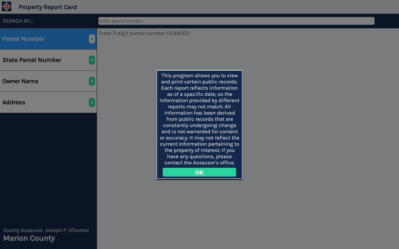
Use it to identify the parcel, then label mailing and situs fields separately in any by-address notes.
Note: A homestead field or tax mailing address can support research, but neither names every person living at the property.
Map Indianapolis Parcels by Street
MapIndy turns one property-card result into a view along the block. The official MapIndy help page explains address and parcel searching, layer controls, selection, printing, and linked city apps. Select the matched parcel, then compare adjoining parcel shapes and addresses. Layers can supply neighborhood, ZIP, township, municipal boundary, permit, and community-organization context. Those layers explain where a site falls; they do not certify who occupies it.
The map helps near Beech Grove, Lawrence, Speedway, and Southport. These excluded municipalities remain in Marion County although their legal city label differs from Indianapolis. A ZIP polygon, mailing city, assessor situs, and municipal border answer distinct questions. Preserve each label.
The illustrated MapIndy instructions show the supported search and map tools.
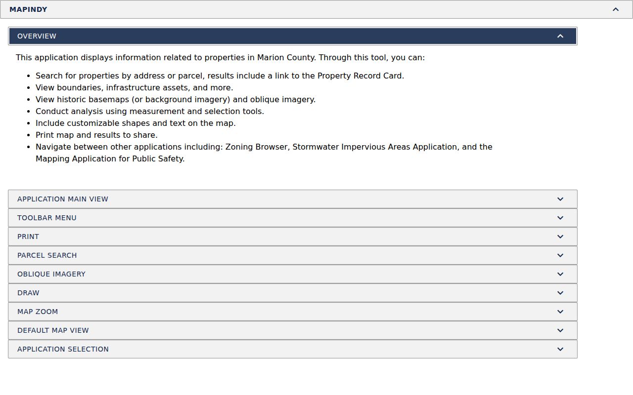
The help view is the safest reference when controls change in the live map.
Indianapolis Records Keyed by Address
No official Indianapolis street directory combines all residents. Several systems accept an address or connect to a parcel, and each has a narrow purpose. The table keeps ownership, geography, filings, civic cases, and historical publication evidence apart.
| Address record | Keeper | What it shows | Access |
|---|---|---|---|
| Property card | Marion County Assessor | Owner, situs, mailing address, parcel, transfer and value | Web search; office fallback |
| Parcel map | Indianapolis GIS | Shape, address point, ZIP, township, neighborhood and city layers | MapIndy, REST catalog, GIS help |
| Deed, lien, mortgage, plat | Marion County Recorder | Parties, date, legal description and document reference | Direct Search; office, phone, email or APRA |
| Permit or enforcement case | Indianapolis agencies | Address, type, status, date and role-linked names | Accela and GIS table |
| Historical street page | Library partners | Published names at an address in one year | Digital volumes, microfilm and staff help |
Voter records use a separate channel. The Indiana status portal serves voters checking registration and election information, not an open name-by-address roster. Public file requests have statutory rules and protected-address exclusions. Ask Marion County elections about the lawful request path.
Follow Indianapolis Deeds by Street
The Marion Direct Search reaches recorded real-estate instruments beginning in 1821. Search modes include party, document type, file number, book and page, town, lot and block, legal description, map, parcel, and case or parcel number. Date ranges and document types can keep a common street or surname manageable. CAPTCHA and page limits are part of the service.
Older references need special syntax. Records through 1949 use a book code with book and page, while 1950 through March 31, 1964 uses an instrument number beginning with A. Deeds, town-lot deeds, liens, mechanic's liens, mortgages, and miscellaneous books have distinct codes. Read the Recorder search guide before deciding an older filing is absent.
- Parcel
- A county identifier for mapped land. It is more stable than owner spelling, though numbers can change.
- Situs address
- The address where property lies, distinct from the owner's mailing address.
- Plat
- A recorded map dividing land into lots, blocks, streets, or easements.
- Criss-cross directory
- A directory ordered by street or address rather than only surname.
For counter help, contact the Marion County Recorder at 200 E Washington Street, Room 741, at 317-327-4020, or recorder@indy.gov. Ask for an existing index, image, or named series. APRA cannot require a new resident list.
Indianapolis Street Permits and Cases
The Accela Citizen Access portal searches permit, land-use, and enforcement cases without an account. A free account adds saved history, invoice, and status functions. Address search can connect work or enforcement activity to a parcel, but an applicant, contact, or owner must be described by the role shown.
The public code-enforcement table adds case number, type, status, open date, street address, owner, township, and a link. Since results can paginate, save query terms and check later pages. An open date does not show when a household arrived, and a closed case does not establish who lived there.
The official permit search presents public record categories by address.
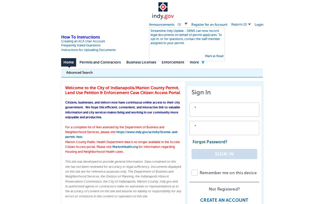
Read each result's category and status before adding it to a street record.
The code-enforcement address table exposes its public fields.
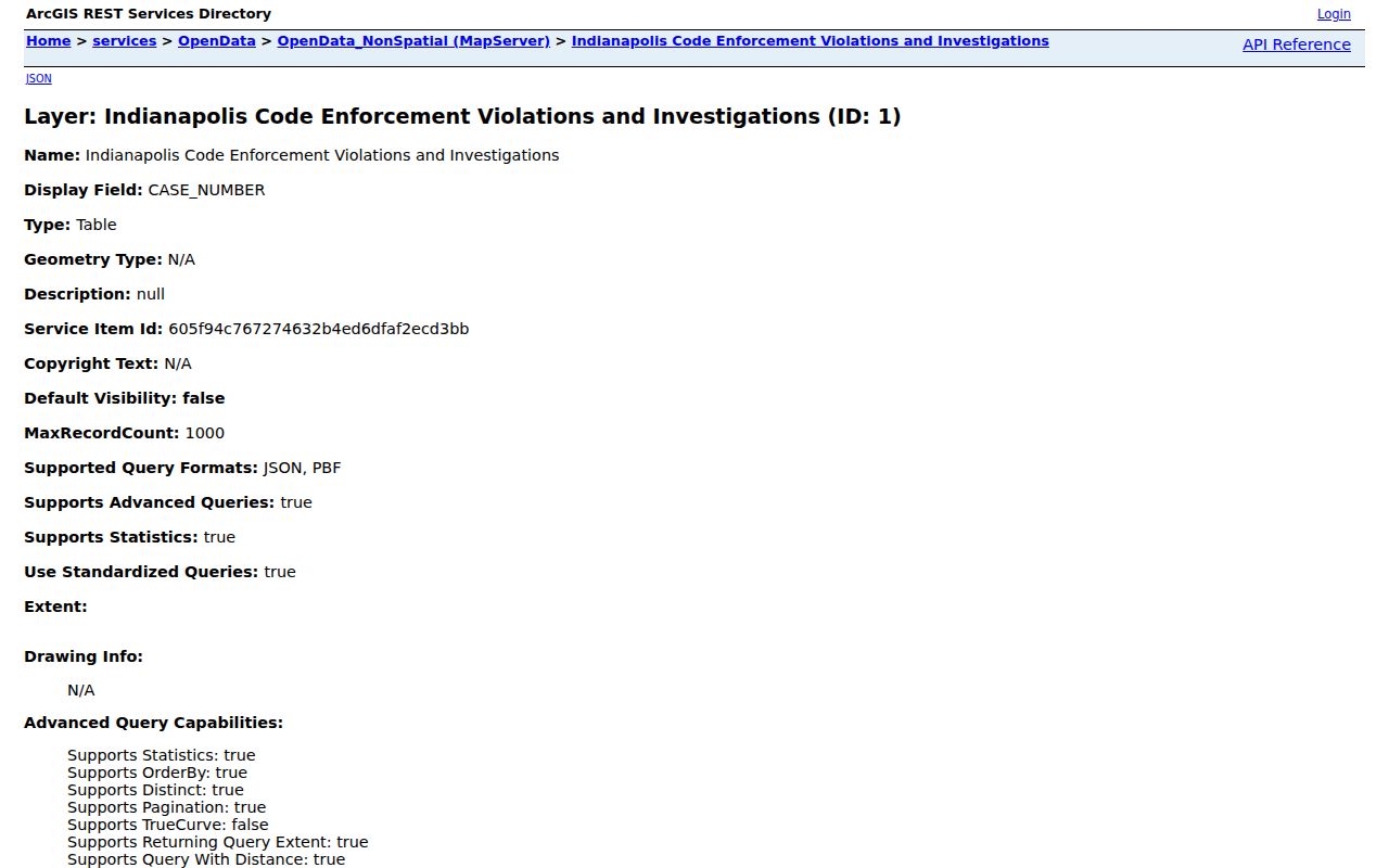
Owner and address fields provide case context, not a full household list.
Indianapolis Street Numbers Changed
Indianapolis changed street addresses in 1887, 1899, and 1916. This local quirk can make a sound historical search look empty. A household did not necessarily move because its number changes between volumes. The IndyPL house-history guide recommends directory street guides with Baist and Sanborn maps to bridge the printed address to the modern parcel.
Write the address exactly as printed. Search alphabetic and street sections for the same year. Then check the next volume and a period map before changing the number. Modern ZIPs should not be projected backward. Current neighborhood labels also need a date when paired with an older street.
Note: A missing old address is often a numbering or coverage problem, so test nearby years before concluding the household left Indianapolis.
Browse Old Indianapolis Streets
Historical directories bridge a recorded owner and people named at an address. Indianapolis directories begin in 1855, the city series ends in 1989, suburban books continue through 1991, and a Marion County directory appeared in 2001. Research did not confirm one complete separate modern reverse-directory run. Ask the library for street pages, microfilm, or staff help for the exact year.
Early volumes can omit areas or list only surnames. Pre-1914 entries may lack an address, and an Indianola Avenue example shows weak coverage before 1923. Browse the scan when optical character recognition, or OCR, finds no result. OCR is computer-read text and often misreads initials and old numbers.
The historical shelf is covered in the Indianapolis city directories collection; use it when the task shifts from one street to whole volumes.
Indianapolis Street Labels Can Diverge
Indianapolis covers a broad consolidated geography, but Marion County, the legal city, a ZIP polygon, and the USPS mailing city remain different layers. A street may cross a township, neighborhood, ZIP, or municipal boundary. Compare the assessor situs with city and town layers, then use USPS for the recognized mailing line.
GIS is geographic evidence. USPS is postal evidence. Neither proves a named person is present. This keeps a by-street search accurate near county edges and avoids calling every Marion County address part of legal Indianapolis.
Limits of Indianapolis Street Records
Property and civic systems do not publish a complete household roll. An assessor card can name an owner while missing renters, relatives, roommates, and other occupants. A deed party may be a grantor, grantee, trustee, or lien claimant. Permit contacts and voter data have their own purposes and rules. Indiana Address Confidentiality Program records are not ordinary public lookup material.
Describe only what the record says, with its date and custodian. For lawful family history, estate work, scam checks, or neighborhood research, confirm a name through more than one source. Do not expose sensitive details irrelevant to the task.
Lawful use. Indianapolis address records may be used for lawful personal research, never to stalk, harass, threaten, or harm a person.